Waypoints
Waypoints can be shown on maps as orientation markers but also act as a source for route points in competitions. The waypoints can be entered, listed or modified on this page.
Unless a text filter has been specified all waypoints inside the database are listed. To manually add a new waypoint
touch the +
symbol in the navigation bar. To delete one or more waypoints touch Edit
. To inspect or
modify data of an existing waypoint touch the waypoint's information symbol.
On the details page geographic data can be entered manually or - if you are at the to be entered waypoint - the iPhone
can use its current location to enter the data automatically. In the latter case the button take over
has to be
touched.
Remark: If the location or the altitude cannot immediately be determined, press the button
take over
a couple of times.
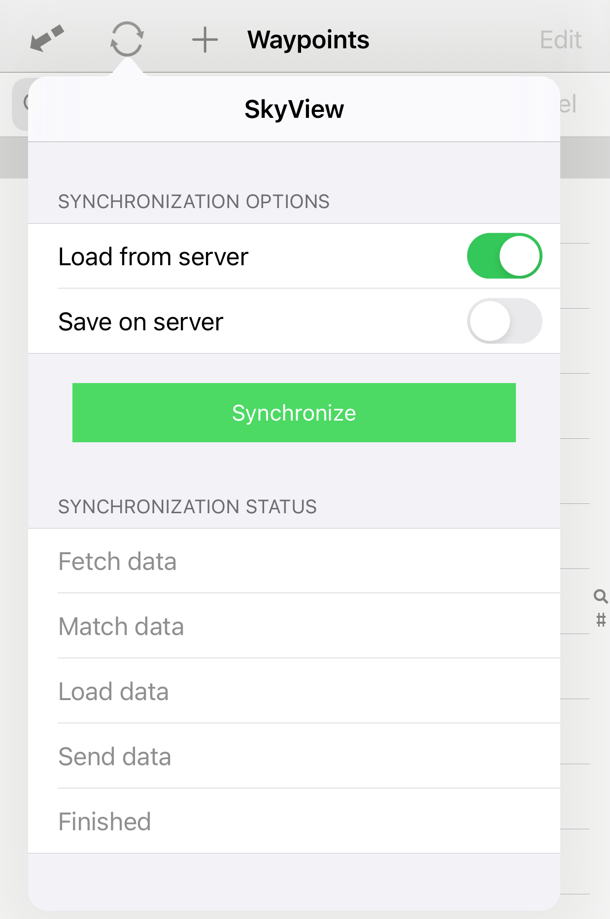
An alternative to entering a waypoint is to downloaded it from SkyView by touching the synchronization button in the toolbar. This opens the SkyView-popover. By touching the green button a connection to the SkyView server is established and the stored waypoints are downloaded.
You can share your waypoints with everybody by uploading ("save on server") the waypoints to SkyView! To do so you first have to register yourself at SkyView in the preferences.
Another possibility of entering waypoints is to copy CUP or GPX files into SkyLogger's
document folder. These files show up after having touched
 in the
navigation bar. Select the files from which you want to import and touch again
.
in the
navigation bar. Select the files from which you want to import and touch again
.