Terrain instrument
The terrain instrument shows the terrain, displayed in brown color, in flight direction. The terrain's profile is shown over a pre-selected distance. Additionally, the pilot's current altitude is visualized as a dashed green line. If the glide ratio can be determined, too, the likely glide path is shown as a solid red line. The terrain instrument can be individually sized on the map like all the other instruments.
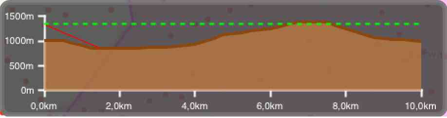
As the determination of the terrain's profile needs quite some computing power the battery is drained stronger than during normal operation. Therefore, the functionality of the terrain instrument is deactivated in the beginning. This setting can be changed in the preferences for the instruments.
Remark: To show the terrain profile height data has to be available. You can download GTOPO30 height data by selecting the corresponding tile of the world within the preferences in the height data section.